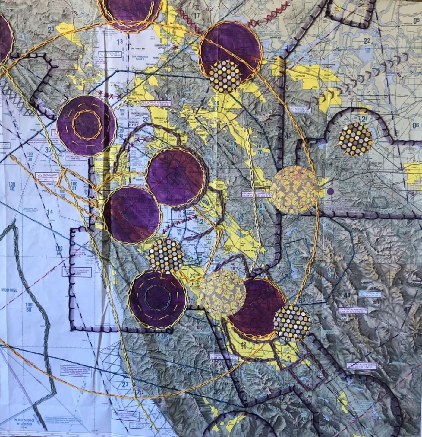
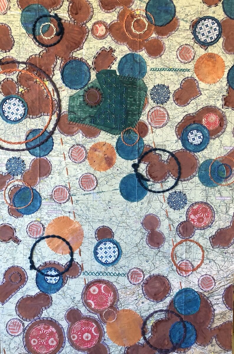
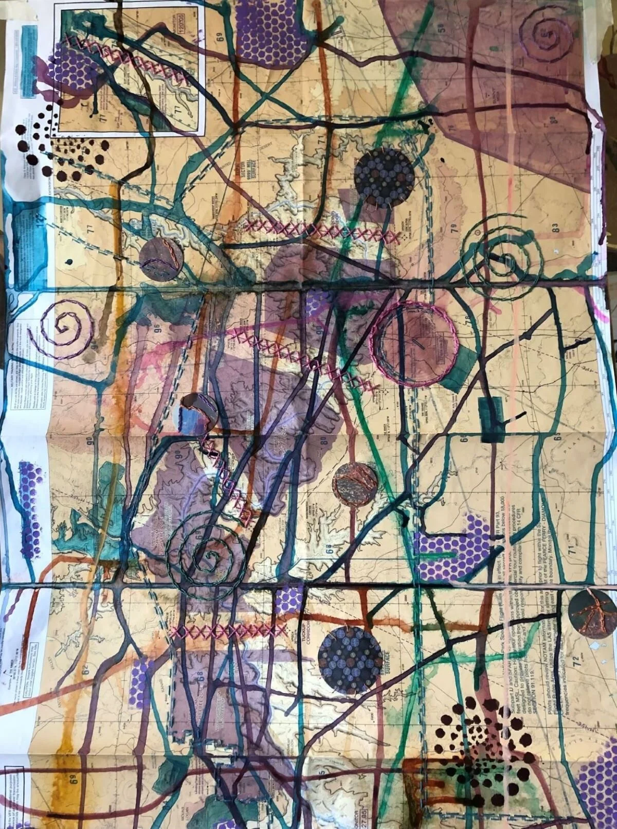
Map-based Collage
Map-based Collage Artist Statement
I begin with aviation sectional maps that are used by private pilots as they fly. They contain landmarks, altitude levels and other necessary information to use when navigating using instruments or visually. I select areas that are marked on the map to highlight, first with acrylic ink, then add hand embroidery stitches, stenciling, poured ink and collaged paper shapes to add pattern and visual interest. The transparent layers allow the viewer to see the underlying landscape of cities, roads, and lakes, as well as the invisible lines the FAA draws around airports. The poured lines imitate the meandering lines of rivers, lakes, and other naturally occurring landscape forms. My work highlights the geometry of this unseen carved-up airspace and merges it with a purely abstract version of shapes, color and texture.